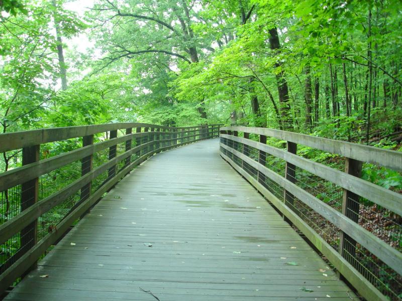
We recently talked about Charlottesville’s Walk Score, which, a few years ago, named us the most walkable city in Virginia, and now we have some more information for our Solutions audience on many of the lovely walking/hiking/biking/running trails that circle in and around the city.
Charlottesville Parks and Recreation, according to their website, maintains nearly 6 miles of paved, and about 30 miles of nature trails. Multi use trails exist at Riverview Park (and upstream along the Rivanna river), Meade Park, at Schenk’s Greenway, Mcintire Park, John Warner Parkway, and at Forest Hills Park. Nature trails also exist in the woods of many City parks and alongside creeks.
The Rivanna Trail is a handicapped-accessible paved trail that starts at Riverview Park and heads north about 2.3 miles, crossing under Free Bridge and Route 250 East along the Rivanna river. The trail is a public right-of-way across private property so the city asks hikers to please respect this by staying on the path.
Schenk’s Greenway is a crushed-gravel surfaced trail, good for hiking, biking and strollers. While traveling along the 1/4 mile trail beside a stretch of McIntire Road towards the Downtown Mall, you can enjoy views of Schenk’s Branch creek and Art-in-Place sculptures.
This section of trail is only the beginning of a much longer route that will soon connect to Preston Avenue and now also heads north into McIntire Park via the John Warner (Meadowcreek) Parkway. Due to the sewer line replacement project, Schenk’s Greenway trail will be closed from approximately July-November, but will be rebuilt and open for use by December 2015.
A number of nature trails run along the creek and through mature forests at McIntire Park. Enter the trails behind the picnic shelters, to the north of the baseball fields, or from the CHS bridge.
There are three parallel trails running north of the descent to the CHS bridge and one running south to Melbourne Road from the bridge. There are also trails on the east side of the railroad tracks just north of the McIntire golf course. Enter behind the guardrail to the right of the gate to the leaf dump on Melbourne Road.
A soft-surface trail connects Greenleaf Park with Walker School and the school administration building. Go past the raingarden and down the hill into the woods. The trail to the school goes to the left along the creek and 250 bypass. There is a smaller trail connecting the park to neighborhoods to the south.
The Pen Park Nature Trail is a 1.5 mile trail that runs along the Rivanna River. It’s a combination of a wider main path and a number of side trails that offer closer views of the river.
To reach the trail, enter the park and turn left at the tennis courts. The trailhead is behind the picnic shelters. Pass through the fitness trail and continue down the hill along the fence line to the river. Follow the path to the right (downstream). To return you can follow the new trail up to the cemetery and clubhouse, or retrace your steps back to the fitness trail. This 1/2 mile paved loop offers 20 stations for a variety of stretching and fitness opportunities while jogging or walking.
A 1/4 mile paved trail connects Forest Hills Park with the Prospect and Johnson Village neighborhoods. The trail passes through mature woods.
The Rivanna Trails Foundation (RTF) footpath runs through the middle of Greenbrier Park along Meadow Creek. Within the park, the trail is wider than usual and there are a few benches for resting. Access is available from Greenbrier Drive at RTF trailheads near the elementary school. The RTF passes through this park and includes a number of spur trails providing a variety of circuits through wooded and open area.
Explore the woods and creek valleys behind Buford School and Smith Recreation Center on these footpaths built by volunteers.
Trails at Riverview, Quarry and McIntire Parks are on the Virginia Birding and Wildlife Trail –http://www.dgif.virginia.gov/
Just outside of Charlottesville is the Ivy Creek Natural Area Trails, a 4-mile loop trail that features a lake, walks along the Reservoir and is rated as moderate. The trail is primarily used for hiking and is accessible year-round.
Another popular trail is the Saunders Trail at Monticello, which was developed by the Thomas Jefferson Foundation to create a scenic entrance along Route 53 to Monticello. The Parkway also serves as a pedestrian and cycling link between Monticello and the local community.
A 2-mile trail winds through the park before ascending the side of Carter Mountain toward Monticello over the stone-arch Saunders Bridge. A pedestrian underpass at the lower trailhead that leads to additional parking will constitute the final piece of the project.
New trails currently under development include:
The City has been awarded a MAP-21 grant to extend the 250 bypass trail under Dairy Bridge and west to Hydraulic Road. Plans are nearly complete and construction could occur by fall of 2015. The 250 Bypass-McIntire Park Multi Use trail from Dairy Bridge to McIntire Park trail behind the fire station is complete, including two new bridges.
Trail construction will be completed west in 2015 and the east end will open when the YMCA is complete. The trail is planned to eventually connect to the Meadow Creek trail system near Hydraulic Road.
Meade Avenue Multi-Use Trail – from railroad to Meade Park – VDOT funded grant to construct multi-use trail along the east side of Meade. Construction of phase 1 is nearly complete, phase 2 was to have begun in late 2014. The trail will support biking, walking, strollers, wheelchairs, and other forms of non-motorized transportation.
Moores Creek – Trail easement acquisition underway between Rives, Quarry, Jordan and Azalea Parks.
For additional information or questions regarding trails, contact the Park & Trail Planner via email atgensic@charlottesville.org or via phone at 434-970-3656.

